
Digital Government and Smart Cities

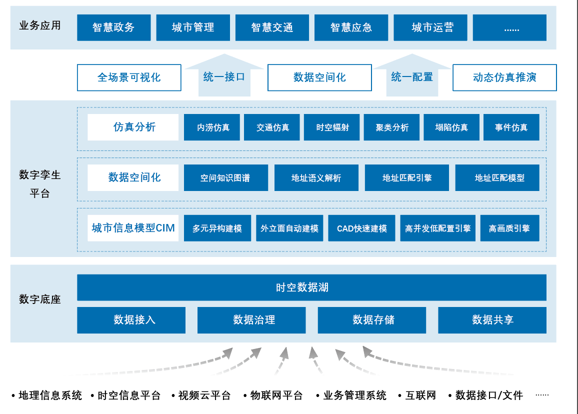
The Digital Twin Platform integrates technologies such as the Internet of Things, big data, BIM, GIS, and artificial intelligence to build a three-dimensional digital city that corresponds to a physical city. Through basic urban information modeling, the key elements such as people, things, and events in the region are spatially mapped into the urban information model to promote the transformation of urban management to a mode with correspondence between reality and reality and synergistic interaction. The platform helps managers better grasp the operating rules of the real world through digital twin cities and assists in urban planning, business management, monitoring, research, and judgment of risks, and emergency command and dispatch activities.

1. Twin-engine rendering and automatic modeling
The platform supports the rapid generation of real facades for hundreds of thousands of buildings at the city level by means of low-cost aerial photos and tilt photography. It can perform low-cost rapid modeling based on existing CAD drawings and quickly generate BIM data through CAD drawings.
2. Intelligent mapping of address data based on AI
The platform combines NLP and spatial computing technology to realize automatic coupling and intelligent matching of geographical coordinate data and automatically converts spoken and non-standard text addresses into map coordinates in real-time.
3. Rich simulation and spatio-temporal analysis capabilities
The platform provides a variety of simulation and deduction capabilities (waterlogging simulation, indoor fire simulation, traffic flow simulation and prediction, etc.) to provide support for multi-dimensional observation, global coordination, and proximity-based scheduling of resources in cities, realize visual domain analysis, interpolation analysis, and clustering analysis for various applications, and assist in urban management and operation decision-making.
4. Provide "low-code" secondary development tools
The platform provides a rich low-code APIs, supports multi-type data fusion, seamlessly integrates with various business platforms, and is inherently compatible with various types of geographic information data in the industry to achieve deep correlation of map data.


Through urban information model CIM, data spatialization, simulation analysis and management, the platform builds digital twin cities, empowers various business applications, and provides panoramic visualization, multi-dimensional observation of cities, full data analysis, and comprehensive stereoscopic perception services for various application scenarios such as smart government affairs, smart transportation, smart emergency response, and urban IOC. It can effectively improve cross-departmental decision-making and resource coordination efficiency, promoting sustainable high-quality development of cities.

Scenario 1: Digital twin city modeling and regional planning management
Based on the artificial intelligence conditional random field algorithm, the platform divides spatial data such as massive urban POIs, buildings, road networks, and pipe galleries into spatial elements of the finest granularity.. Based on the artificial intelligence conditional random field algorithm, the platform establishes a refined three-dimensional city model combined with factor correlation, and utilizes an efficient dual rendering engine to achieve high-quality images on large screens and PCs.

Scenario 2: Refined pipeline gallery management
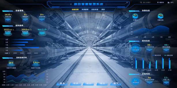
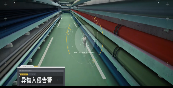
Through the construction of three-dimensional models of underground pipelines and pipe galleries, the platform accurately obtains monitoring data such as pipeline IoT sensing, automatically gives warnings, accurately locates pipeline abnormalities through intelligent patrols, and seamlessly monitors the operating situation of pipelines and pipe galleries to achieve daily safety maintenance and management.

Scenario 3: Urban waterlogging and flooding simulation deduction
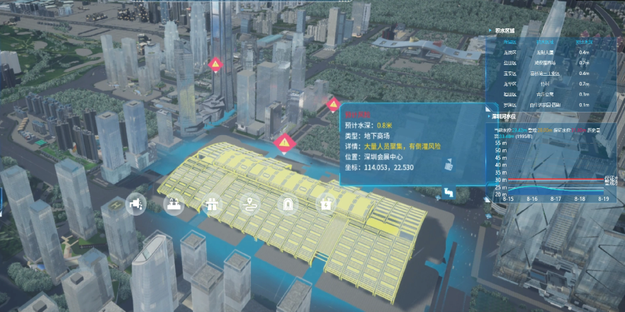
The platform combines rainfall data, surface runoff data, pipe network convergence data and other data from past rainstorms to build an urban flooding simulation and deduction model, which can be used daily to simulate and deduce the flooding of the city's existing pipeline network, optimize the facilities of the regional drainage network, and improve the emergency prevention and control capabilities. When a torrential rain event occurs, the platform assists in calculating the evolution of waterlogging at regional flooding points, and predicts those areas that may be submerged.

Scenario 4: Emergency command and dispatch
When an emergency occurs, the platform combines spatiotemporal algorithms to present the distribution of key factors and resources such as peripheral risk hazards, key buildings, places of refuge, emergency supplies, and rescue teams in a single map, assisting managers to carry out command and scheduling. By obtaining real-time traffic data, the platform can quickly calculate the time and distance for rescuers to reach the rescue point, draw more accurate alarm circles, reinforcement circles, and surroundings, and issue emergency plans and instructions with one click, efficiently facilitating emergency rescue.


Guangzhou "SuiZhiGuan" Urban Operation Management Center
Integrated Command and Dispatch Platform for "Ordering, Prohibiting, and Responding" in Huangpu District, Guangzhou
Smart City Operation and Command Center of Yiyang City, Hunan Province
Intelligent Analysis Platform of of the High People's Court of Zhejiang Province
The Cloud Base and Urban Operation and Command Center of the New Smart City of Wangcheng District, Changsha, Hunan Province
Smart City Operation and Command Center of Wugang City, Henan Province
Ningbo Fenghua CCCC Future City Operation Center